Super-cold thunderstorm sets temperature record

Gordon_R

Honorary Master
Joined
Jul 5, 2009
Messages
24,895
Reaction score
23,013
Location
Kenilworth, Cape Town
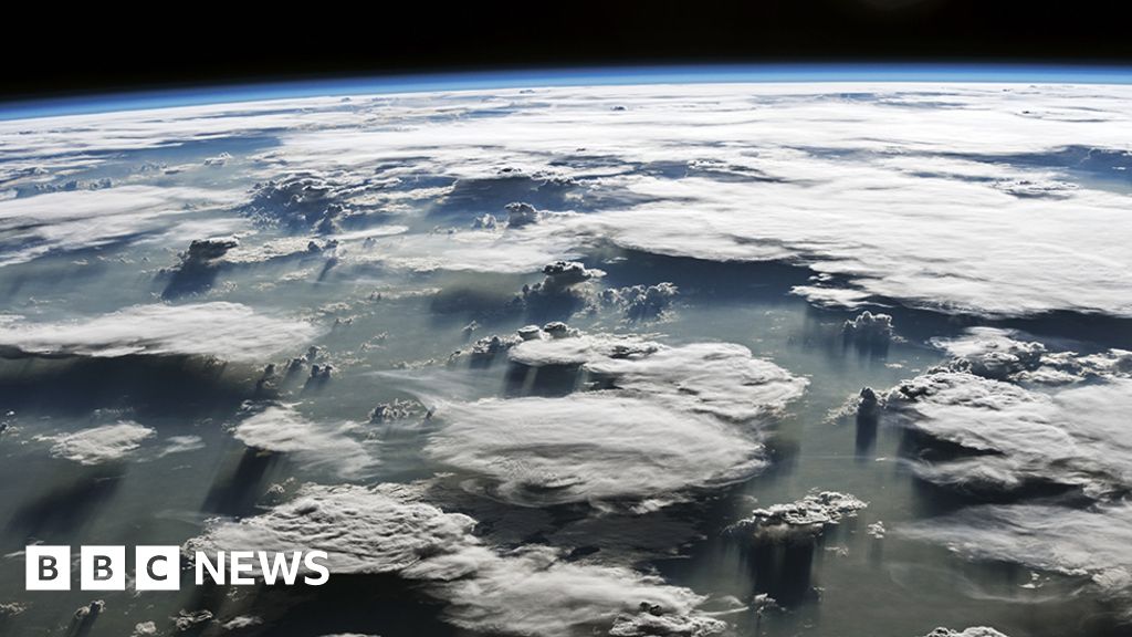
We've all seen those majestic anvil storm clouds that form on a hot summer's day, but what do you think is the temperature right at the very top?

It's very cold, obviously; at high altitude it is well below freezing.

But would you be surprised to learn it is sometimes below even minus 100C?

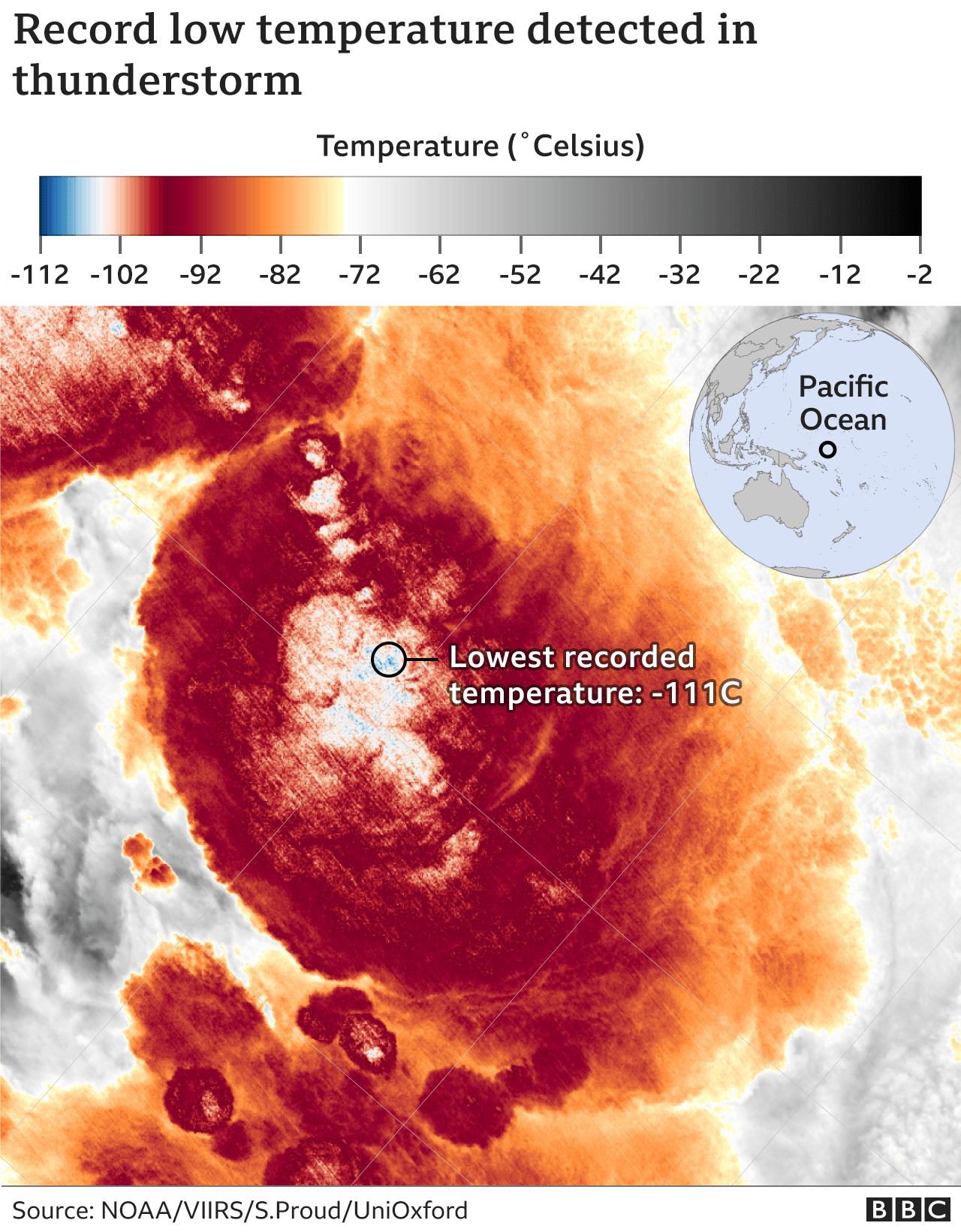
Indeed, scientists have just published research showing the top of one tropical storm cloud system in 2018 reached -111C. This is very likely a record low temperature.

It was seen on 29 December that year, just south of the equator in the western Pacific. The measurement was made by a passing American satellite, Noaa-20.
_117724033_cold_cloud_temperature_640map_2x-nc.png
 
Why is that? I've seen some incredible anvil clouds above Paarl often.

From the OP link, which I didn't quote. I somehow assumed people would read the article:
When a powerful upward draft reaches the top of the lower atmosphere, or troposphere, it will normally flatten and spread out to form that classic anvil shape.

But if the storm is very energetic, the upward movement of air can punch through the troposphere's ceiling, the tropopause, to keep on rising into the stratosphere, the next layer up in the atmosphere. In the 2018 event, the cloud top was at about 20.5km in altitude.

Typical thunderstorms are quite big, but not that extreme...
 
Wow, with a cloud top of 67000ft o_O I don't think even Concorde flew that high
 
Wow, with a cloud top of 67000ft o_O I don't think even Concorde flew that high

Concorde seldom crossed the tropics, due to fuel range limitations. The altitude of the tropopause/stratosphere boundary is lower the further you get away from the equator. The whole aim was to fly in smooth stable air. You don't want to be flying at Mach 2 in severe turbulence...
 
What's really interesting is that this observation is just one of many real clouds. NOAA 20 is a new class of low orbit observation satellites, unlike the geostationary ones we are familiar with. As such it rapidly passes over the area of interest, and only covers a fraction of the earth in each orbit. Normal weather observations get average data over large areas (several square kilometers) from their high orbits, and would not be able to measure such precise details.

Reference: https://en.wikipedia.org/wiki/NOAA-20
 
Concorde seldom crossed the tropics, due to fuel range limitations. The altitude of the tropopause/stratosphere boundary is lower the further you get away from the equator. The whole aim was to fly in smooth stable air. You don't want to be flying at Mach 2 in severe turbulence...

Yes, but Concorde cruised at around 60 000ft (around the same height as that storm, where most storms will be significantly lower than 65 000ft) :D just like normal airliners and smaller aircraft you fly around thunderstorms, it doesn't matter if you're flying at 125kts or 500kts or M2.0 you stay away from the menacing tall clouds

Fun fact, there is still remnants in aviation law regulating aircraft that perform like Concorde

CAR 121.05.7 - An air service operator of an aeroplane which is intended to be operated above 49 000 feet, shall ensure that the aeroplane is equipped with an instrument to measure and indicate continuously the dose rate of total cosmic radiation being received and the cumulative dose on each flight.
 
Top
Sign up to the MyBroadband newsletter
X