Cape Town Fire/Smoke Alert Thread

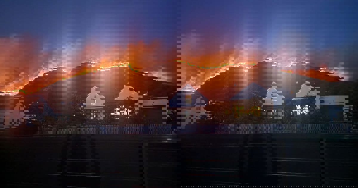
That camera has poor quality for night images which is making it seem worse that it probably is. But the fire is burning downhill and Boyes Drive is a great place to stop it. I would not be worried if I was a Kalk Bay resident (unless significant NW wind picks up). Plus previous burns in that area have created zones which will not burn.
seems fire is about 200m above boyes drive right now
 
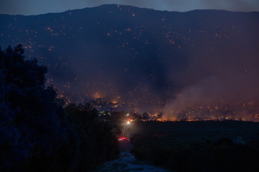
The fire burned late into the night (as seen from Kenilworth). Closest to me is Constantiaberg, and a large circle of fire was slowly glowing up the slopes, barely moving in almost windless conditions. Scattered flames were visible further south, some producing an eerie glow off the smoke plumes.

This morning there is fog in Kenilworth, so I can't see anything. Winds are light to fresh NW, so the general trend from yesterday will continue. Further spread will be limited by urban boundaries such as Boyes Drive, etc.

Google maps, based on satellite infrared images, shows the approximate perimeter:
 
Update:
Fog has lifted somewhat, revealing a lot of haze and smoke, but much less active burning (compared to yesterday). Winds are light and variable, but the many spot fires (and large perimeter) are going to take a long time to extinguish...

Edit: Choppers are back in the air, as containment efforts continue:
 
Last edited:
I can see smoke from large fires in the lower Tokai area, as westerly winds push down into the valley.

More roads have been closed on the urban edge:
- Main Road, Lakeside
- Main & Clairvaux
- Steenberg & Tokai Road near the Circle
- Tokai and Zwaanswyk
Aerial firefighting efforts are currently focused on hotspots above Ou Kaapse Weg and along the slopes towards Vlakkenberg.

Edit: I see moderators have moved this into the News forum (I didn't make a request).
 
Last edited:
Another news source:
Fire and rescue teams have been fighting the wildfire throughout the night, with about 250 City firefighters, assisted by Table Mountain National Park, Working on Fire, the NCC and Volunteer Wildfire Services.
 
18:40 Burning towards the tar road to the Constantiaberg mast, flames visible between the mast and beacon. Also heading down from Muizenberg peak towards Boyes again.

1745861881503.png
 
Last edited:
Muizenberg and Lakeside
 

Attachments

  • ce1fff68-3e8f-4e22-9b78-2db246a4341c.jpeg
    ce1fff68-3e8f-4e22-9b78-2db246a4341c.jpeg
    133.9 KB · Views: 14
so this is what CPT is known for? weird strange weather, random wildfires


why now though?

Isnt winter supposed to be here, or like everything in CPT
fires are like the weather, just starts whenever it feels like.

not gonna lie, was wondering driving along the N2 what those smoke clouds were from
now I get to see it more closer to the mountain.

man this place gets weirder the longer I stay here, now fires, if the cold and wind and rain weren't enough.
 
so is that what this is? burning land so it doesn't ignite later on?
they did that up in the vaal at the end of winter tho, so not sure here what fire season is.
Yes. They're destroying property and evacuating people as part of a controlled burn.
 
so this is what CPT is known for? weird strange weather, random wildfires


why now though?

Isnt winter supposed to be here, or like everything in CPT
fires are like the weather, just starts whenever it feels like.

not gonna lie, was wondering driving along the N2 what those smoke clouds were from
now I get to see it more closer to the mountain.

man this place gets weirder the longer I stay here, now fires, if the cold and wind and rain weren't enough.
I've never seen someone struggle so much with the concept of a Mediterranean climate
 
Top
Sign up to the MyBroadband newsletter
X