Rain and storm for Cpt

Status
Not open for further replies.
So annoying that they closed the schools on thursday, there was no storm our side and we have just had 3 weeks of school holiday.

Not having power for 33 hours just made it feel like the pandemic again.
Everyone gets brought down to the same level.
 
I'd defer to @Gordon_R here as he seems to have the data at his fingertips, but I'd venture a guess that this week's rain does not even register as a blip in the record of high rainfalls for the metropole and Winelands in the longer term. I'm sure we've had 10 black South-Easters worse than this. We had some pretty big storms in the Boland in the 80's.

As mentioned, increased population and bad drainage management makes this look a lot worse than it is. Keep paving over everything and the water can't go anywhere.

The numerous mudslides we're having are also not just because of rain. We've just come out of one of our worst fire seasons where most of the fires were due to arson. These mountain sides are destabilised, and the resulting mud slides are making it look a lot worse that it normally would.

All good points. There is quite a lot of variation in the weather (in time and location), and in the yearly data averages. A single cold front produces a finite amount of rain. Random fluctuations bringing a series of closely spaced and intense fronts are what produces flooding (along with all the man made factors). Groundwater is another big factor, but one which is least visible, and hardest to study.

For reference the SAEON Dwarsberg mountain weather station is the wettest place in SA, with an annual average of 3000mm. Any given year can range from 1500mm to 4000mm. A single day would rarely reach 200mm, but several such days in a row produce the incredible inflows into the Berg and Theewaterskloof dams (not rain over the dam itself).

The data from this week have been interrupted by snow (which freezes the gauge solid), and wind which affects the telemetry.

P.S. This is the 'flood gauge' on our lawn in Kenilworth, where I have lived for decades, and fills every few years:

IMG-20240709-WA0000.jpg
 
except if you are living in a shack... but yes, the rest of us get knocked down a notch or 2
Government schools/headmasters need to be empowered to be able to make their own decisions. Teachers should still attend. Learners’ attendance should be optional. Most parents would agree that work must go on. We cannot live by weak men ways.
 
Government schools/headmasters need to be empowered to be able to make their own decisions. Teachers should still attend. Learners’ attendance should be optional. Most parents would agree that work must go on. We cannot live by weak men ways.
Considering where you live, your words could not be more apt.

Anyways, we have the merest zephyr right now, and sun like weak tea. Going to nip out for some more mushrooms.
 
you mean to tell me the so called train line could collapse and with it isolate the province from the rest of SA?

luckily we dont have terrorists in SA or nothing.
It has collapsed, - the one power line pole is lying half way in the water probably only hanging on the cables, and its a double overhead cables, so no trains on other line, even if it could hold any weight, which i doubt, likely the whole bank is unstable - and is likely to be further undermined

Just outside Worcester next to N1 - yellow area likely washed away.
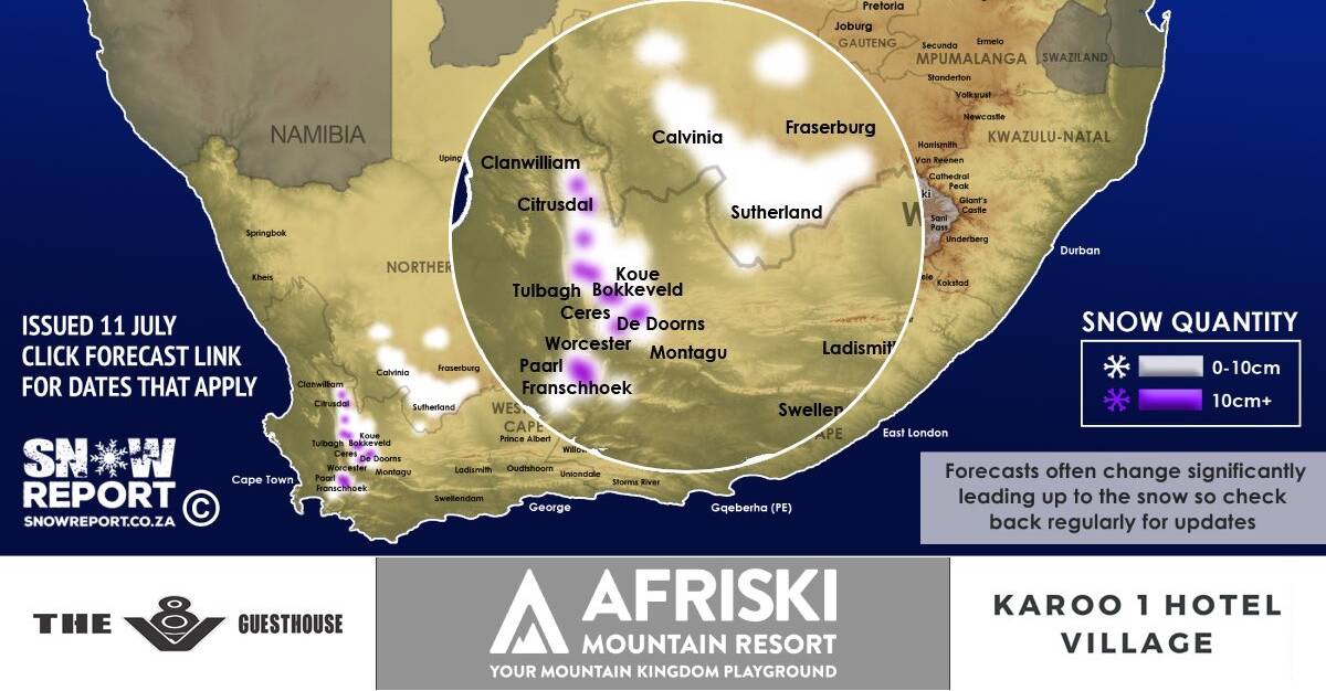
100cm of Snow from Matroosberg Range melting with the last 72hrs of rains did this.
Significantly more runoff than normal with the additional snow melt (which was a massive dump of snow, most in 8 years i think).
1720782959164.png
 
so @Rocco1 you mean to tell me there isnt another line trains could use? and this single "choke point" could get blocked and no trains could go in or out,
again, how is it nobody has thought to make more than 1 line,

again, floods and nature can happen anywhere, the whole point is there is more than 1 line in and out to share the load with.
 
so @Rocco1 you mean to tell me there isnt another line trains could use? and this single "choke point" could get blocked and no trains could go in or out,
again, how is it nobody has thought to make more than 1 line,

again, floods and nature can happen anywhere, the whole point is there is more than 1 line in and out to share the load with.
There is the iron ore line going to Kurriman in NC, that probably could be used to divert some trains around, but not sure of the connections from the CT port to the iron ore line Saldanha (is it all powered?) and the Upington connection that can divert off the iron ore line.


Dont worry though, we mainly use trucks for logitistcs since PRASA has got worse and worse.
Probably transport of bulk goods might suffer
 
It has collapsed, - the one power line pole is lying half way in the water probably only hanging on the cables, and its a double overhead cables, so no trains on other line, even if it could hold any weight, which i doubt, likely the whole bank is unstable - and is likely to be further undermined

Just outside Worcester next to N1 - yellow area likely washed away.
100cm of Snow from Matroosberg Range melting with the last 72hrs of rains did this.
Significantly more runoff than normal with the additional snow melt (which was a massive dump of snow, most in 8 years i think).
View attachment 1739415

Warm rain after heavy snow produces severe runoff, and the Hex River is not capable of carrying such large volumes of water. This particular one could potentially be blamed on climate change.

They could possibly reopen one line in a few weeks of stabilisation, and there is hardly enough traffic on the route to bother with urgent repairs to the second track.

so @Rocco1 you mean to tell me there isnt another line trains could use? and this single "choke point" could get blocked and no trains could go in or out,
again, how is it nobody has thought to make more than 1 line,

again, floods and nature can happen anywhere, the whole point is there is more than 1 line in and out to share the load with.

Cape Town is quite geographically isolated, and the cost of infrastructure means that only a few key routes were built. Train lines have the most difficulty in mountainous terrain, and there is simply no feasible alternative route.
 
Moon and stars peeking through getting my hopes up for being outdoors tomorrow morning but every forecast says rain rain rain.
 
The DWS site shows that the Theewaterskloof Dam rose by another 6% yesterday to 91% this morning (Fri 12th) up from 68% on Mon 8th. The inflow has been absolutely astonishing, and shows few signs of abating. It seems quite likely that the dam will overflow before the end of July.

View attachment 1739267

The outflow from the Berg River Dam has halved overnight, and the risk of flooding seems to have diminished.

Source: https://www.dws.gov.za/Hydrology/Unverified
Thats 23% in 4 days…Insane amount of water!!!
 
Status
Not open for further replies.
Top
Sign up to the MyBroadband newsletter
X